

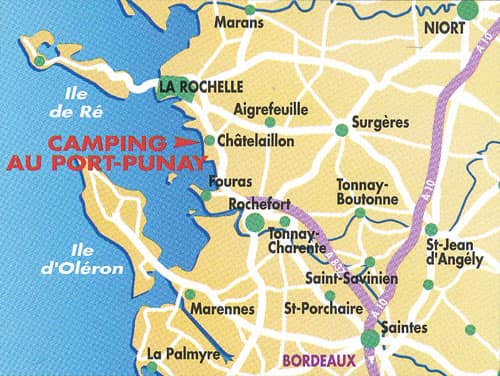
How to find us Châtelaillon-Plage / La Rochelle
France -> Nouvelle-Aquitaine – Poitou-Charentes -> Charente-Maritime -> Châtelaillon-Plage (near La Rochelle)
Châtelaillon and its surroundings are very well served in public transports, and at 150m of the campsite a bus will take you to the center of La Rochelle.
By bike : The Vélodyssée cyclepath will take you from Roscoff all the way to Hendaye and will lead you through the Charente-Maritime. From the Two Towers of La Rochelle you can follow the coast line and end up at our site in Châtelaillon-Les Boucholeurs. The next day the inland path will take you further down to Rochefort and Royan.
By plane : Bordeaux airport (150km) or La Rochelle airport (25km).
By train : TGV from Paris to La Rochelle (15km). TER from La Rochelle to Châtelaillon-Plage, then take the bus n°20 to the “Les Boucholeurs” stop.
By car : Motorway A10, exit La Rochelle. Just before La Rochelle follow the national road N137 and take the exit Châtelaillon-Plage. At the first roundabout take “Châtelaillon-Plage”. At the second roundabout take “Les Boucholeurs” and then follow “Camping au Port-Punay”.
By bus: Châtelaillon and the surrounding area have a good bus connection. At merely 150m from the campsite, bus 20 brings you to the center of La Rochelle.
| Paris: | 475 kms | 4h45 |
| Poitiers: | 144 kms | 1h37 |
| Nantes: | 166 kms | 1h57 |
| Bordeaux: | 164 kms | 1h40 |
| Coordonnées GPS : Lat : N 46° 3′ 17″ et Long : W 1° 4′ 59″ 46.054910, -1.083310 |
Charente-Maritime (17)
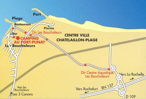
Campsite Map